
'/%3E%3Cpath%20fill='%23b2b2b2'%20d='M241%20382q0%2016%2017%2026%2017%2011%2042%2011t42-11q16-11%2017-26V269H241'/%3E%3Cpath%20fill='%239f7e00'%20d='M241%20379q0%2014%208%2023%209%209%2021%209%2014%200%2021-9%209-9%209-23V269h-59'/%3E%3Cpath%20d='M241%20339v-70h59v110q0%2014-9%2023l-6%205v-68h-15v72q-8%200-14-4v-68zm59%2040c0%2022%2015%2032%2029%2032%2021%200%2030-18%2030-32v-40h-59'/%3E%3Cpath%20fill='%239f7e00'%20d='M266%20277v5h2v12h-3v-5h2v-5h-9v5h2v5h-4v9h3v18h-5v10h34v-10h-5v-18h3v-9h-4v-5h2v-5h-9v5h2v5h-3v-12h2v-5zm42%20101q0%2010%206%2017%206%206%2015%207%2010-1%2016-7%206-7%206-17v-29h-43'/%3E%3Ccircle%20fill='%230044ad'%20cx='329.5'%20cy='372'%20r='6'/%3E%3Cellipse%20fill='%230044ad'%20cx='300'%20cy='340'%20rx='16'%20ry='21'/%3E%3C/svg%3E)


Irrigation Mapping Software — WiseConn DropControl
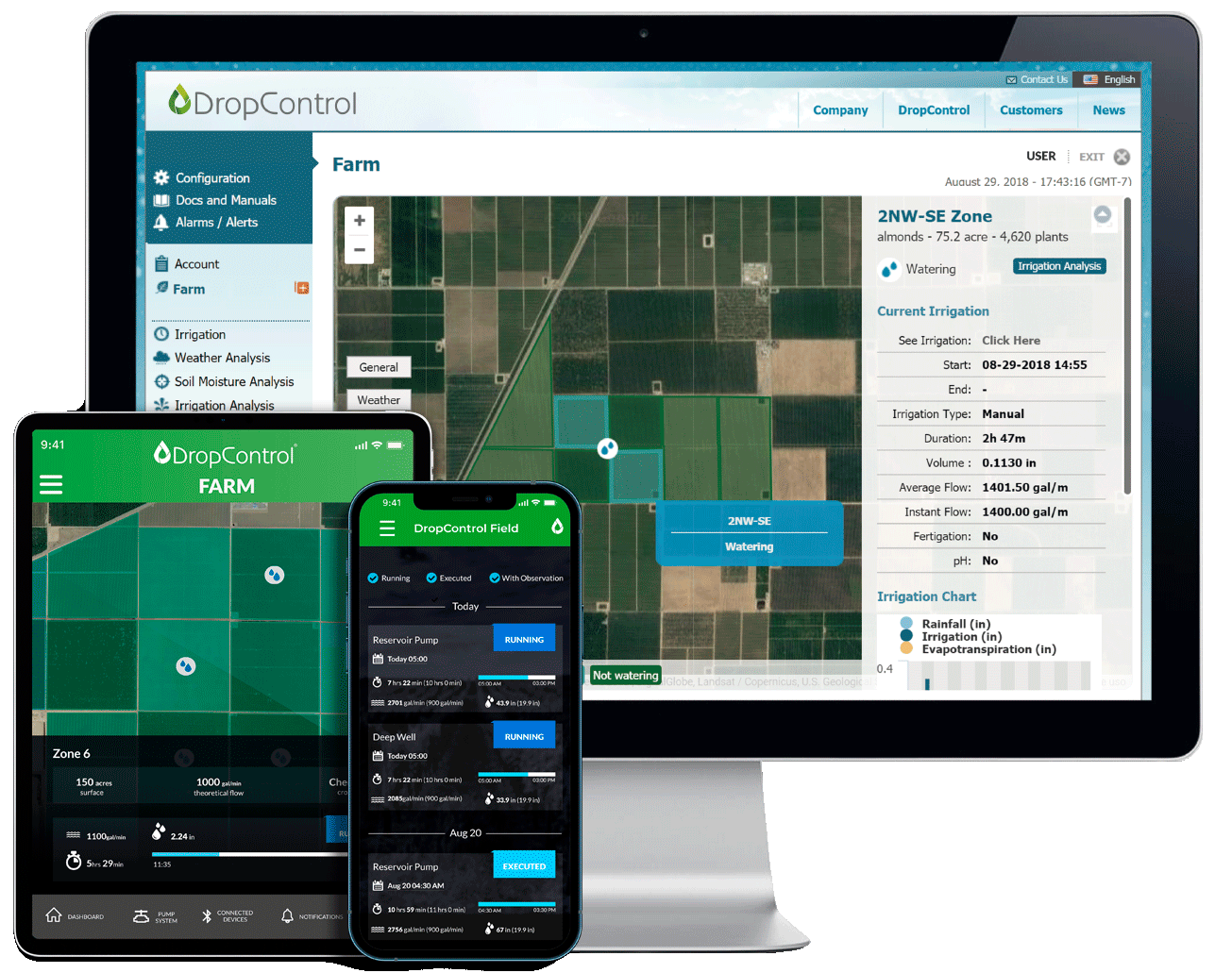
See your whole operation on a map. DropControl's mapping lets you manage irrigation visually, by zone, so you act where it actually matters instead of treating the whole field the same.
What it does
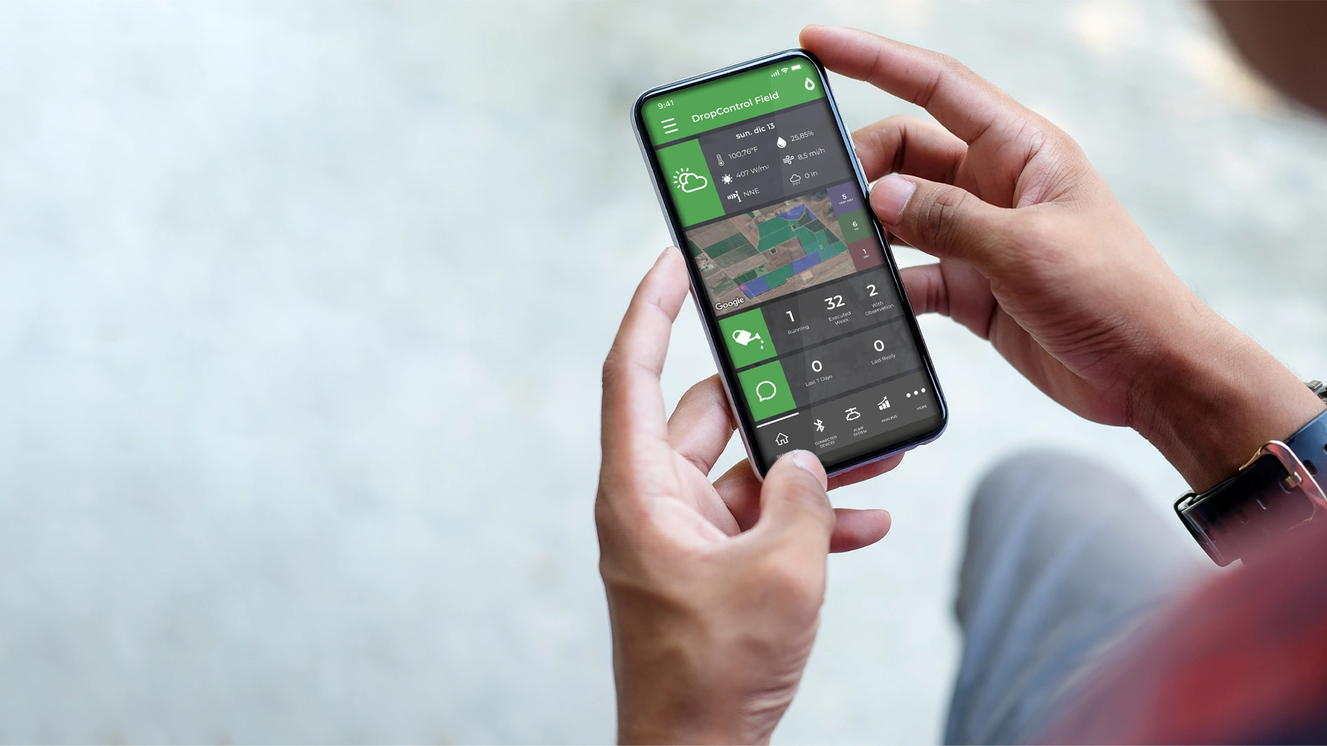
DropControl lets you map your fields, blocks and irrigation infrastructure, so you manage irrigation visually instead of from a list. You see soil, weather and irrigation status by zone, on the map, and act where it matters.
Who it is for
It is built for growers managing multiple blocks or fields who want a visual, map-based view of what is happening and where.

Key capabilities
- Map fields, blocks and irrigation infrastructure.
- See soil, weather and irrigation status by zone on the map.
- Manage irrigation by zone, not one-size-fits-all.
- Part of the DropControl web and mobile platform.
What it means for your operation
Manage field variability visually and irrigate by zone, so a dry corner or a heavier soil does not force you to over-water the rest of the field.
Part of the WiseConn system
Every WiseConn device works with the DropControl platform and connects wirelessly, so you manage everything from one web dashboard and mobile app. It also works with the sensors and equipment you already have, on an open architecture that does not lock you into a single vendor, and you can start with one piece and scale to full automation at your own pace.
Why growers choose WiseConn
More than 3,000 growers use DropControl every day to manage irrigation across thousands of fields around the world, on top of the systems and sensors they already run.
Frequently Asked Questions
Request a quote
Ready to bring precision irrigation to your operation? Talk to a WiseConn specialist and get a quote tailored to your operation. WiseConn solutions are delivered and installed through a certified distributor network, so you get local support from day one.